
Trace a Herndon Street Directory
A Herndon street directory search works best as a chain, not as a list of presumed occupants. MAR first confirms the site-address string and parcel. Jade then shows the parcel shape and its place on the block. iCare supplies the assessment card, including the owner, situs location, parcel number, legal description, sales, values, and tax tabs. The Fairfax Circuit Court land-record index supplies the legal-instrument trail. A reverse directory can supply a historical address-to-occupant clue, but it is not a current-residence guarantee.
For a recent address, use the fields exactly as each custodian labels them. An owner of record, owner mailing address, historical occupant, and registered voter at an address are different findings. Virginia's Citizen Portal is an individual self-service tool, not a public street browser. A controlled voter-list request has limits under state law, so it cannot fill the gaps left by property and directory sources.
- Enter the street number and name in MAR to validate the situs address, ZIP, city value, and parcel connection.
- Search iCare for the assessment card, then record the PIN and legal description along with the displayed owner field.
- Open the same parcel in Jade GIS to inspect parcel boundaries, nearby lots, historic blocks, or imagery.
- Search the owner as grantee in Fairfax Land Records, using the PIN, legal description, and recording date to keep the chain on the right parcel.
- For an earlier household, ask the Virginia Room for a reverse or criss-cross directory, then compare its address entry with the deed and map evidence.
Note: Save the access date and source label with every street result because address, assessment, and map layers can change.
Herndon Street Search Tips
Fairfax Department of Tax Administration iCare is the property-card starting point for the modern Herndon street directory. The property-location form accepts a street number, unit, street name, and suffix. It also offers map-number and map modes. Its help recommends leaving the suffix blank for a broader match. A wildcard before or after a street name can help browse a road when its name is not certain.
| iCare field | How it helps a street search | Format note |
|---|---|---|
| Number | Targets a single street number | Optional |
| Unit# | Narrows a unit when shown on the parcel | Leave blank for the whole parcel |
| Street | Finds a named road or browses street matches | Name only; wildcards are supported |
| Suffix | Refines a street type | Optional; iCare recommends leaving it blank first |
| Map number or map | Uses the parcel key or a map selection | Partial map number can use an asterisk |
The iCare property-location form shows the core address fields used for this work.
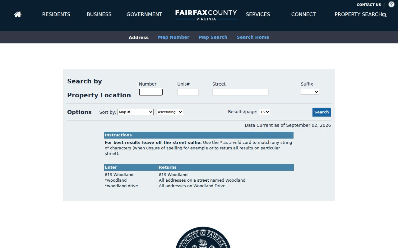
After selecting a result, keep the card's owner, mailing address, parcel information, legal description, and Sales, Values, and Tax links separate in notes. Owner-name display can be withheld online by written request, so a missing displayed name is not proof that the parcel has no owner of record.
Map the Herndon Street Directory
MAR and Jade serve different parts of a Herndon street-by-street search. MAR is Fairfax County's authoritative address, parcel, and street engine. It can filter by address number, street name and type, city, ZIP, parcel ID, subdivision, and created or expired dates. Jade supplies the visual parcel geometry. Its layer controls can show parcels, political jurisdiction, tax districts, addresses, historic blocks and lots, aerial imagery, and other thematic layers.
Use MAR before treating a postal city label as a Town location. A Herndon city value can be postal or local, not proof that the parcel falls within incorporated Town limits. In Jade, select the parcel, inspect the report, and export only the result needed for the particular research question. The map identifies geometry, while iCare and Land Records supply the ownership trail.
The Fairfax GIS entry point introduces Jade and its parcel, aerial, and historical-map tools.
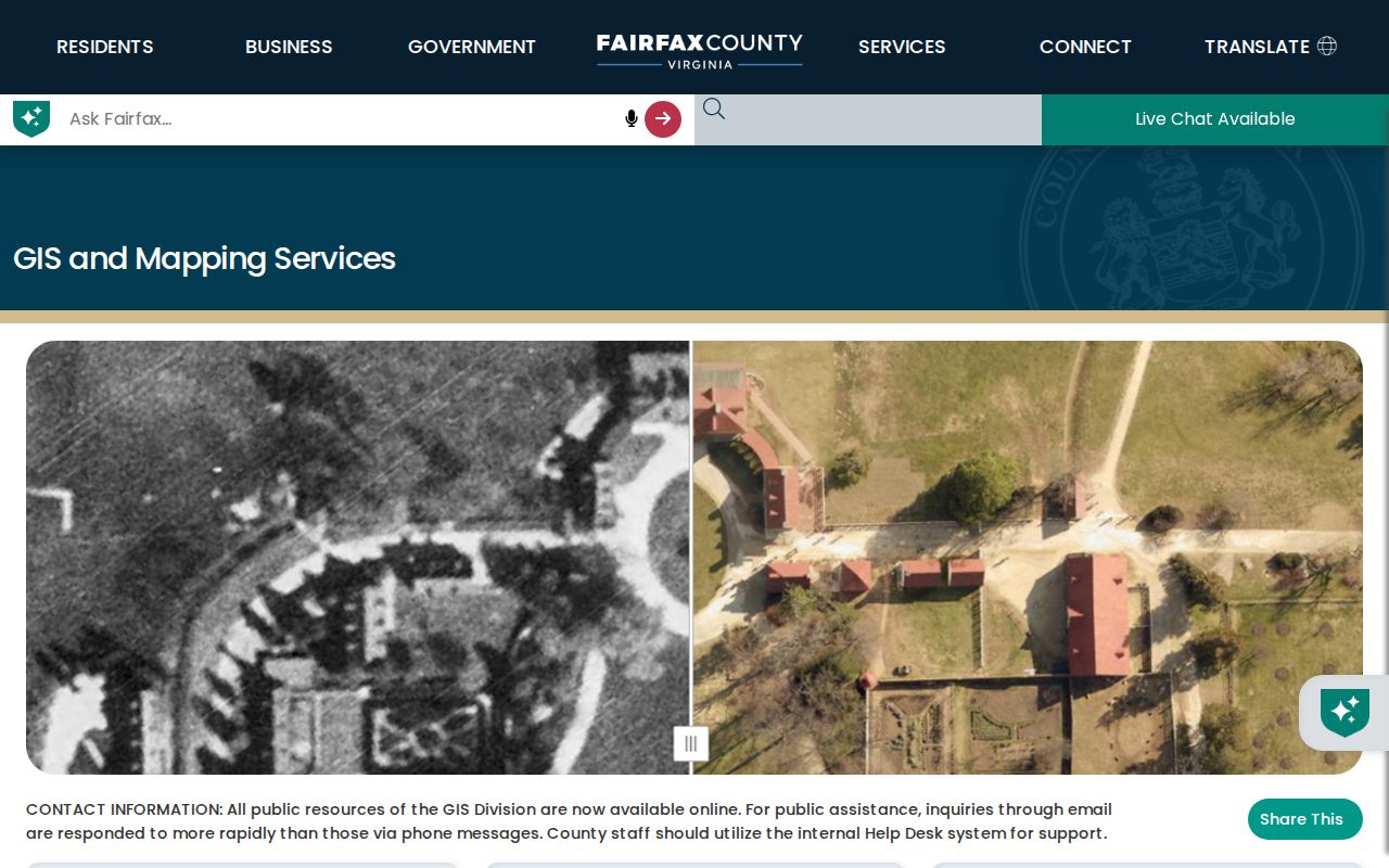
This viewer is useful for seeing how a street segment, lot pattern, and nearby parcels fit together before opening the individual property cards.
Herndon Street Address Myth
The street directory's most important caution is that iCare shows two different addresses. The situs is the parcel's physical location. The owner mailing address is where tax mail is sent. It may be elsewhere in Fairfax County, in another state, or at a post-office box. The mailing field is a location clue for an owner, not evidence that the owner occupies the Herndon parcel.
A deed can add another complication because it may use an older address or only a legal description. Keep the PIN and legal description with the modern address. Those stable parcel keys help distinguish same-name owners and help bridge an address change. A homestead or exemption indicator may be worth evaluating, but it is not conclusive evidence of occupancy.
Follow Herndon Street Deed Chains
The property card leads into the legal record rather than a resident list. Search the current owner as grantee in the Fairfax land-record index near the acquisition date. Use the parcel number, legal description, book and page or document reference, and recording date to separate matching names. The purchase deed identifies the prior grantor. Searching that seller as a prior grantee continues the title chain backward.
Fairfax Land Records has deeds, plats, easements, liens, releases, and related instruments from 1742 forward. CPAN provides remote subscription access, while public courthouse terminals are the no-subscription option. The Historic Records Center keeps deed books through 1942 and warns that some early books and index ranges are missing. Land Records handles the post-1942 physical and index research split. A negative online result should be checked with the appropriate research room before it is treated as a dead end.
- Parcel
- A defined piece of land identified in Fairfax records by a PIN or other parcel key.
- Situs address
- The physical street location of that parcel, distinct from the owner's mailing address.
- Plat
- A recorded map that can connect a lot, block, subdivision, and street layout.
- Criss-cross directory
- An address-first directory that can point from a street number to a past occupant or business.
Copies cost $0.50 per page and certification adds $2 according to the land-record FAQ. Mail requests, research-room access, and CPAN are separate channels, so confirm current copy terms before sending payment.
Check Herndon Address Permits
Fairfax PLUS adds building, planning, zoning, site, enforcement, and related records to an address search. It accepts record number, project name, record type, date range, city, state, ZIP, unit, and Parcel ID Number. Search the number and street name first, omit the street type when the portal guidance calls for it, and try an asterisk with a legacy FIDO number when needed.
PLUS can return a project or permit trail and approved site-related PDFs. It does not establish a full occupant history. Some project files may be destroyed five years after completion, and some records three years after final inspection. Town-specific zoning, historic-review, and planning actions remain a separate layer. Use Herndon Community Development or the Town FOIA channel for an existing Town record not shown online.
Note: Permit dates can help date work on a parcel, but they do not identify every person who lived at that address.
Herndon Historic Street Patterns
For an older Herndon street, begin with the historic address context rather than a modern map label. The Town grew around the railroad depot, and the historic-district survey identifies an 1878 map, later nineteenth-century growth west of the railroad, and the 1895 Van Vleck Addition. These maps, plats, lot and block descriptions, and railroad landmarks can connect a historic entry to a current parcel.
No official Herndon street-renumbering or comprehensive renaming project was located. That is a research gap, not proof that a particular road never changed. MAR's created and expired date filters can help show address lifecycle changes. Town Community Development, Public Works, and a Town FOIA request are the documented places to seek an official readdressing record.
Herndon Street Directory Records
The following sources are keyed to an address, a parcel, or an instrument connection. They answer different questions. MAR validates the address. iCare records assessment and ownership fields. Jade maps the parcel. Land Records establishes a legal chain. PLUS supplies development records. Historic reverse directories add an address-first lead. None of them, alone or together, creates a complete list of everyone in a household.
| Address record | Custodian | Street-level result | Access route |
|---|---|---|---|
| MAR | Fairfax GIS | Validated situs, ZIP, parcel, subdivision, and address dates | Free filter and download |
| iCare assessment card | Fairfax DTA | Owner, mailing address, PIN, legal description, value, sales, and tax tabs | Free web search; online owner suppression is possible |
| Jade GIS | Fairfax GIS and DTA | Parcel shape, nearby parcels, districts, imagery, and reports | Free select, report, and export tools |
| Land-record index | Circuit Land Records and HRC | Parties, instrument, date, book or page, and legal description | CPAN, research rooms, and paid copies |
| PLUS and site records | Fairfax Land Development Services | Permit or planning record, dates, reviewer, and approved PDFs | Free public search; older files may be unavailable |
| Reverse directory | Virginia Room | Historic address-to-occupant or business clue | Reference assistance; exact Herndon run needs confirmation |
The PIN and legal description are stronger cross-record links than a street name alone. For full historical directory collections and how to read their abbreviations, use the Herndon city directory collections after the address chain is established.
Herndon Street History Gaps
Street-by-street research can stop at an archive boundary. Fairfax deed books begin in 1742, but most loose papers from 1742 through 1865 were destroyed, stolen, or lost. Deed-book gaps also exist. The Historic Records Center advises researchers to confirm availability before relying on a negative search. Tax books, newspapers, surviving deeds, and FamilySearch can provide a second route when an expected paper is absent.
The 1917 Crippen building fire destroyed much of the town and Fortnightly material. That loss matters when an older Herndon street produces fewer local names than expected. Surviving maps, land records, Virginia Room directories, and the Herndon Historical Society's research materials are more useful when their limits are stated plainly.
Herndon Street Directory Limits
A public street directory cannot identify every person at a home. Non-owner occupants, household members, utility customers, and DMV address data are not public address indexes. A voter address may be protected, and the public Citizen Portal does not search everyone on a block. Deeds prove a recorded transaction or interest, not that a party lives there now. A property card's owner field and mailing field need the same caution.
Use these records for a lawful personal purpose such as property history, family research, civic transparency, or checking an official filing. Do not publish a protected address or treat a partial source as a complete household record. When records need correction, retain the source URL, access date, parcel or document number, and the exact field at issue for the responsible custodian.
Lawful use. Fairfax and Herndon address records are for lawful research. Stalking, harassment, intimidation, or use of protected address details can violate Virginia law.